

The Red Center
The drive down from Darwin to Alice Springs along the Stuart Highway wasn’t too exciting. I expected a much more different vegetation around Alice Springs, but it looks quite similar to the one up in Darwin. Of course, there are different plants there, but I didn’t expect that many trees, bushes and grass. The highway is named after John McDouall Stuart and his expedition in 1860. There’s one major attraction on the way South, though: Devils Marbles.


Alice Springs
Alice Springs (most people just call it Alice) is a 35k city in the middle of Australia. It’s pretty much the only sensible city between Darwin in Australia’s North and Adelaide in the South. From ANZAC Hill you have a nice look over the city and you can see some of the mountains of the MacDonnell Ranges.


West MacDonnell Ranges
From Alice I drove over to the West MacDonnell Ranges. The mountain formation provides some waterholes that are suitable for a short, refreshing swim even at the end of the dry season. You want to make sure, though, to not stay in the water too long as the water is very cold which may result in hypothermia. There are also a couple of nice camping spots out there.


Kings Canyon
The Kings Canyon is only 320 km southwest of Alice but getting there is a bit of a challenge when you passed the West MacDonnell Ranges before. You either have to go back to Alice and make your way from there or you use a heavily corrugated, private, gravel road (155 km) which requires a permit. Due to severe temperature and the difficulty of the track (there’s a steep ascent at the beginning and no shade on the top), the Kings Canyon Rim Walk requires starting the 6.5 km walk before 9 am. Rangers will lock the gate if the weather forecast predicts more than 36 °C.


Ayers Rock (Uluru)
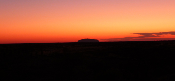
Uluru / Ayers Rock is probably Australia’s most important landmark nowadays. The 348 m high rock was discovered by surveyor William Gosse in 1873 and named after Chief Secretary of South Australia, Sir Henry Ayers. Today Uluru is part of the Uluru-Kata Tjuta National Park. Although it’s not prohibited to climb, the Anangu (the local indigenous people) don’t climb Uluru for its spiritual significance and ask all visitors to respect their culture and not climb Uluru either.


Kata Tjuta
Kata Tjuta is a rock formation about 25 km west of Uluru and consists of 36 domes covering an area of almost 22 km². While Kata Tjuta is not as well known as Uluru, it is 198 m taller. Their colloquial name The Olgas is derived from it’s highest mountain Mt Olga.


